
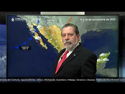
MEXICO CITY.— The National Weather Serviceof the National Water Commissionissued the notice of its weather forecastfrom 06:00 a.m. on Sunday, November 16, 2025.
For this day, low pressure channels over the Mexican southeast and the Yucatan Peninsulawill cause occasional rains forts in Chiapas (center and south), showers in Oaxaca, Veracruz, Tabasco and Quintana Roo, as well as isolated rains in Yucatán.
Other low pressure channel over the west of the country, in combination with the moisture ingress from the Pacific Ocean, will generate showers with electric shocks in Michoacán and Guerrero, as well as isolated rains in Jalisco and Colima.
Finally, in the rest of the national territory, clear to partially cloudy skies will predominate with no chance of rain.

“Mérida” Regional Hydrometeorological Centerof the Yucatan Peninsula Basin Organizationannounced its weather forecast, from 06:00 a.m. on Sunday the 16th until 06:00 a.m. on Monday, November 17, 2025.
The document indicates that, this morning, partially cloudy skies predominate, with some fog occurring in the central area of the Yucatan Peninsula.
In the next 24 hours, the entry of humidity will favor some cloudiness and rain
isolated in the northeast and northwest of Yucatán, center and south of Campeche, as well as in the
state of Quintana Roo. The winds will be from the east-southeast, changing in the afternoon to the east-northeast at 15 to 20 km/h with gusts of 40 km/h in coastal areas. In addition, the environment will become hot during the day and warm at dawn.
Weather in Merida
The temperature forecast for the city of Mérida is in the range of 31 to 33 °C as a maximum and 19 to 21 °C as a minimum. For the interior of the state, the maximum will be 32 to 34 °C in the south and east, minimum 17 to 19 °C in the south.
Current temperature of Merida
At 8:00 in the morning this Sunday, the temperature in Mérida was 24 °Celsius, with humidity of 82% and wind of 5 km/h.
Weather in Yucatan
Partly cloudy skies with isolated rains in the northeast and northwest of the state.
Hot environment during the day and warm at dawn. Wind from the east-southeast and east-northeast of
15 to 20 with gusts of 40 km/h in coastal areas.
Weather in Campeche
Partially cloudy skies and isolated rains in the southern and central areas of the state.
Hot environment during the day and warm at dawn. East-southeast wind changing
in the afternoon northeast at 15 to 20 km/h with gusts of 40 km/h towards the coast.
Weather in Quintana Roo
Partly cloudy skies, with a probability of isolated rains in the north, center
and south of the state. Hot environment during the day and warm at dawn. Wind from the east-southeast and east-northeast at 15 to 20 km/h, with gusts of 40 km/h in coastal areas.

In his social network account “X”, formerly Twitter, Juan Antonio Palma Solísmeteorologist at the meteorological agency Meteored Méxicopredicts some isolated rains for this Sunday, a warm atmosphere in the afternoon and something cool at night.
Palma Solís adds that, according to the meteorological analysis, it shows that the influence of high pressure in the Gulf of Mexico continues, associated with the mass of cold air that gave impetus to cold brake number 13, which he calls “Chechén”, will continue to generate cool nights and dawns.
Likewise, the entry of moisture from the Caribbean and Gulf of Mexico could cause some isolated to scattered rains.
CDMX Climate

The National Meteorological Service (SMN), in its general forecast, foresees for the Valley of Mexico: During the morning, a cold to cool environment is forecast in the region, and in high areas of the Valley of Mexico a very cold environment with frost and fog banks. In the afternoon, a mild to warm environment is forecast, with clear to partly cloudy skies with no chance of rain in Mexico City and the State of Mexico. The minimum temperature in Mexico City will be 5 to 7 °C and the maximum 24 to 26 °C. For Toluca, Edo. Mex., a minimum temperature of -1 to 1 °C and a maximum of 22 to 24 °C is expected. North wind from 5 to 15 km/h with gusts of up to 30 km/h.
How will the weather be?

The SMN, in its forecast by region, anticipates for the Gulf of Mexico: Partly cloudy sky conditions during the day, with showers and possible electric shocks in Veracruz (Los Tuxtlas and Olmeca regions) and Tabasco, as well as isolated rains in Veracruz (Las Montañas and Papaloapan regions); Partially cloudy sky and no rain in Tamaulipas. In the morning, cold atmosphere with frost in high areas of Veracruz, and cool to temperate in the rest of the region. During the afternoon, warm to hot atmosphere. Wind from the east and southeast of 10 to 20 km/h with gusts of 35 km/h to 50 km/h in Tamaulipas, and gusts of up to 35 km/h in Veracruz and Tabasco.
While, for the Yucatan Peninsula forecast: Partly cloudy to cloudy skies are expected; rains with showers and possible electric shocks in Quintana Roo and isolated rains in Yucatán and Campeche. In the morning, temperate environment; in the afternoon warm to hot atmosphere. East and northeast wind from 10 to 20 km/h with gusts of up to 35 km/h in Quintana Roo, Yucatán and Campeche.