
A day of intense cold will take over several regions of the country, according to the weather forecast. These are the details of the forecast:
Cold front 15 will cause frost with sleet or snow in northern and central Mexico, accompanied by heavy rains and winds of 30 to 45 kilometers per hour, warned the National Meteorological Service (SMN).
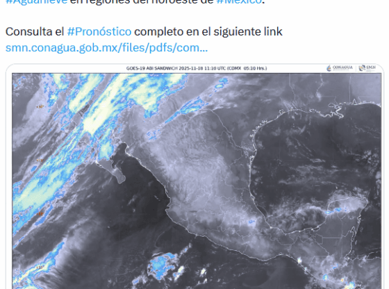
In its daily report, the body of the National Water Commission (Conagua) detailed that, during this morning, The cold to very cold environment will continue with possible frost in areas of the Mesa del Norte and the Mesa Central, so minimum temperatures of -10 to -5 degrees Celsius are expected with frost in high areas of Baja California, Sonora, Chihuahua and Durango.
Consultation: This RESPONDS Sheinbaum about the Michoacán blockades
There will be temperatures of -5 to 0 degrees with frost in mountain areas of Zacatecas, Hidalgo, State of Mexico, Tlaxcala, Morelos and Puebla, and from 0 to 5 in mountainous areas of Coahuila, Nuevo León, San Luis Potosí, Aguascalientes, Jalisco, Michoacán, Guanajuato, Veracruz and Oaxaca.
They will be accompanied by heavy occasional rains in Baja California, Sonora, Guerrero, Oaxaca and Chiapas and intervals of showers in Baja California Sur, Chihuahua, Michoacán, State of Mexico, Morelos, Veracruz, Tabasco, Campeche, Yucatán and Quintana Roo.
Also isolated rains in Sinaloa, Jalisco, Colima, Tamaulipas, San Luis Potosí, Guanajuato, Querétaro, Hidalgo, Mexico City and Puebla, as well as snow or sleet in the mountains of Baja California and northern Sonora.
You may be interested in: How cold will it be this Tuesday in Guadalajara?
The Service forecasts wind of 30 to 45 kilometers per hour with gusts of 60 to 80 km/h in the Gulf of California, Baja California, Sonora and Chihuahua; from 20 to 30 km/h with gusts of 40 to 60 km/h in Baja California Sur, Durango, Coahuila, Nuevo León and Tamaulipas; from 10 to 20 km/h with gusts of 30 to 50 km/h in Veracruz, Tabasco, Campeche and Yucatán.
The force of the winds will cause waves of 1.5 to 2.5 meters high on the western coast of Baja California, they could also cause the fall of trees and advertising advertisements.
The SMN specified that this climate is caused by a polar trough, a cyclonic circulation at medium and high levels of the atmosphere, the polar and subtropical jet streams; as well as a dry line over Coahuila, the subtropical jet stream, a low pressure channel, low pressure channels over the interior and southeast of the national territory, and the entry of moisture from the Pacific Ocean, Gulf of Mexico and the Caribbean Sea.
Forecast for Wednesday, November 19
Cold front no. 15 will travel through the northwest and north of the Mexican Republicwill continue to be associated with a cyclonic circulation and trough in the middle and upper levels of the atmosphere, in addition to the polar and subtropical jet streams, maintaining a marked drop in temperature, showers and heavy rains in these regions; as well as possible snow or sleet in the mountains of Sonora, Chihuahua and Durango.
Lee: New road blockades and burning of vehicles reported in Michoacán
At the same time, winds of 40 to 50 km/h with gusts of 60 to 80 km/h are forecast in Sonora, Chihuahua, Coahuila and Durango; from 20 to 35 km/h with gusts of 50 to 70 km/h in Zacatecas; from 10 to 20 km/h with gusts of 30 to 50 km/h in the Gulf of California, Baja California, Baja California Sur.
Forecast for Thursday, November 20
Cold front no. 15 will gradually travel through the north and northeast of the Mexican Republicwill continue to be associated with a trough at mid and upper levels of the atmosphere, in addition to the polar and subtropical jet streams, maintaining the drop in temperature and the probability of showers and heavy rains in these regions; as well as the possible fall of snow or sleet in the mountains of Sonora, Chihuahua and Durango.
Check: Generation Z What did Sheinbaum say about the violent groups underway?
At the same time, winds of 50 to 60 km/h with gusts of 80 to 90 km/h are expected in Chihuahua, Coahuila and Durango; from 30 to 40 km/h with gusts of 50 to 70 km/h in Nuevo León, Tamaulipas, Zacatecas, Aguascalientes and San Luis Potosí.
On the other hand, a new cold front will approach the northwest of the Mexican Republicwill be associated with a polar trough and the polar and subtropical jet streams, It will cause occasional heavy rains in Baja California (north); showers in Sonora and isolated rains in Baja California Sur.
Besides: Sheinbaum reveals data about López Obrador’s next book
At the same time, winds of 30 to 40 km/h with gusts of 50 to 70 km/h are expected in Sonora; from 10 to 20 km/h with gusts of 30 to 50 km/h in the Gulf of California, Baja California, Baja California Sur and Sinaloa.
SPECIAL / Conagua
With information from the National Weather Service and SUN
* * * Stay up to date with the news, join our WhatsApp channel * * *
OA