
Cold front 14 will travel through part of the Mexican territory this weekend, modifying meteorological conditions. These are the data:
This Friday, the advance of cold front number 14 and several low pressure channels will cause intense rain, wind gusts of up to 80 km/h and waves of up to 3 meters in areas of the northwest, gulf and southeast of the country, the National Meteorological Service (SMN) warned..
According to the daily report of the SMN, The heaviest rainfall is expected in the south of Quintana Roo, where the accumulated rainfall could reach between 75 and 150 millimeters. There will also be heavy rains in Baja California, Campeche and Chiapas, as well as showers in Sonora, Veracruz, Oaxaca, Tabasco and Yucatán, as well as isolated rains in entities of the northeast, center and west.
Don’t miss: LIVE the details of the cold for the weekend
The agency warned that these conditions could cause landslides, increases in rivers and streams, overflows and flooding in low areas, which is why it called for attention to the alerts from the National Water Commission (Conagua) and Civil Protection.
Cold front 14 will also cause wind gusts of 60 to 80 km/h in the isthmus and gulf of Tehuantepec; from 50 to 60 km/h in Baja California, Coahuila, Nuevo León and Tamaulipas, and from 35 to 50 km/h in Baja California Sur, Sonora, Chihuahua, Durango, Campeche, Yucatán and Quintana Roo, which can cause falling trees and advertisements..
Consequently, the waves will also be significant because on the western coast of Baja California and the Gulf of Tehuantepec it will reach between 2 and 3 meters, and in Quintana Roo, heights of 1.5 to 2.5 meters could be accompanied by waterspouts.
Check: How does Grecia Quiroz, mayor of Uruapan, face the dangers?
The SMN indicated that the conditions are the result of the combination of low pressure channels, entry of humidity from the Gulf and Caribbean, atmospheric instability, a cyclonic circulation at medium and high levels, the polar and subtropical jet streams and the approach of the new cold front to the northwest of the country.
For the rest of the territory, an anticyclonic circulation will maintain clear skies, a cold environment at dawn and the possibility of frost. Minimum temperatures could drop to -10 degrees in the mountains of Baja California, Chihuahua and Durango, and between -5 and 0 degrees in the mountains of Sonora, Coahuila, Nuevo León, San Luis Potosí, Zacatecas, Guanajuato, State of Mexico, Hidalgo, Tlaxcala, Puebla and Veracruz.
Other mountain areas, such as Aguascalientes, Jalisco, Michoacán, Querétaro and Oaxaca, will register between 0 and 5 degrees.
Consultation: How many Mexicans keep diabetes under control?
The SMN recommended that the population dress warmly, avoid sudden changes in temperature, stay hydrated and pay special attention to children, older adults and people with chronic diseases.
FORECAST FOR SATURDAY, NOVEMBER 15
The new cold front (No. 14) will enter the northwest of the Mexican territorywill interact with a cyclonic circulation at medium and high levels of the atmosphere on the western coast of the United States and with the polar and subtropical jet streams, causing heavy to very heavy rains, wind gusts of 60 to 70 km/h and a drop in temperatures in Baja California and Sonora.
FORECAST FOR SUNDAY, NOVEMBER 16
The new cold front will slowly travel through the northwest of the countrywill be associated with a trough at medium and high levels of the atmosphere and with the polar and subtropical jet streams, causing a drop in temperature, wind gusts of 60 to 70 km/h, rain and intervals of showers in Baja California and Sonora.
Lee: New evidence of the Carlos Manzo case, through videos on networks
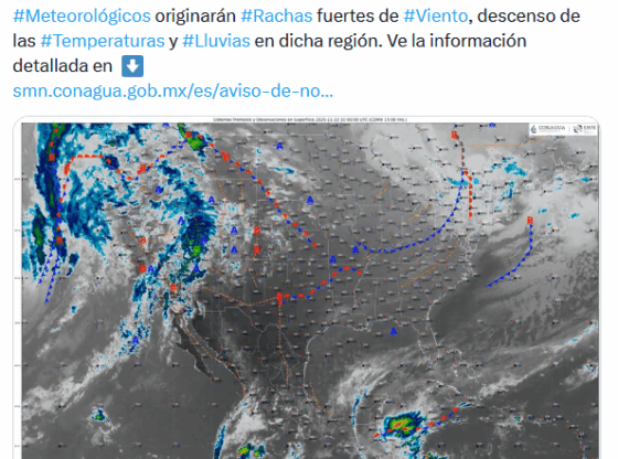
X / @conagua_clima
With information from the National Meteorological Service
* * * Stay up to date with the news, join our WhatsApp channel * * *
OA